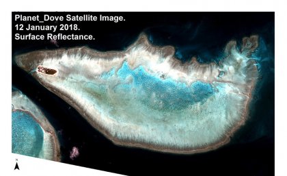
 The University of Queensland is part of a global mapping and monitoring partnership using satellite imagery and big data processing to respond to the crisis facing coral reefs.
The UQ Remote Sensing Research Centre are lead researchers in the global coral reef science and conservation mapping and monitoring program.
In its first year, the partnership will produce five site-based maps, including one of Heron Island, to validate its image processing and mapping methodology.


